GNSS monitoring packages for landslides, dams, bridges, mining subsidence and structural safety projects.
Monitoring solution← All ProductsMonitoring / CORS / Marking Robot / USV / SLAM
GNSS Application Solutions for Monitoring, CORS/VRS, Marking, USV and SLAM
Solution packages for deformation monitoring, CORS/VRS deployment, automated line marking, unmanned surface vehicle survey and handheld LiDAR SLAM mapping.
Application Scenarios
Typical buying contexts for this product category, organized for overseas distributors, contractors and system integrators.
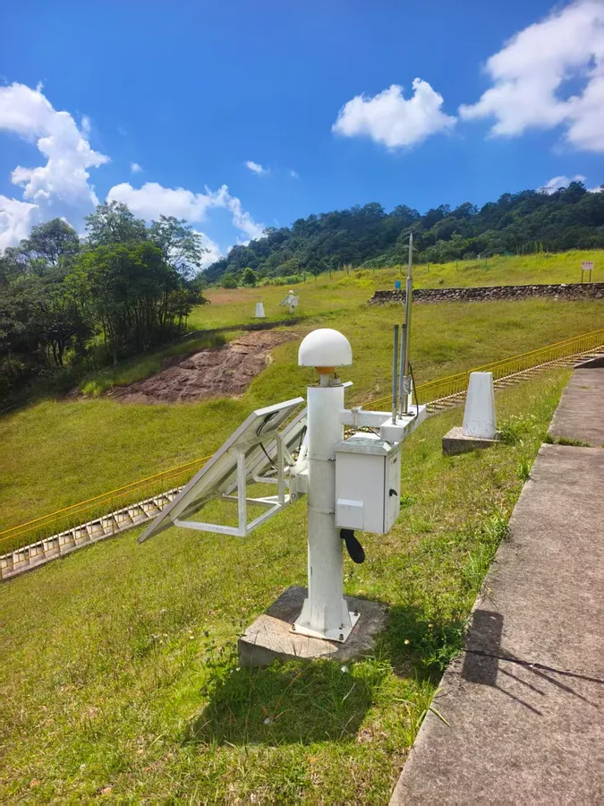
Reference station hardware and correction-service concepts for regional positioning infrastructure.
CORS and VRS solutionRTK-guided marking workflows for sports fields, roads, runways and pre-marking service providers.
TR10Pro Line Marking RobotUnmanned surface vehicle workflows for bathymetric survey, water quality monitoring, patrol and underwater surveying projects.
Tboat10 / Tboat20 USVMobile 3D scanning for indoor mapping, outdoor buildings, digital twins, power line patrol and GNSS-denied environments.
TSR20 Handheld LiDAR SLAMGNSS Application Solutions Lineup
Explain complete project solutions and recommended product mix.
Monitoring solution
Deformation Monitoring Solution
GNSS-based monitoring solution for landslide, dam, mining subsidence, tailings reservoir, bridge and high-rise building deformation monitoring.
Flexible control without line-of-sight between stationsReal-time data outputSafety-focused monitoring workflow
View model details →
Network RTK solution
CORS and VRS Service Solution
Full-stack CORS/VRS service solution for GNSS correction infrastructure projects.
Self-developed software and hardware technologyNetwork RTK service conceptReference station infrastructure
View model details →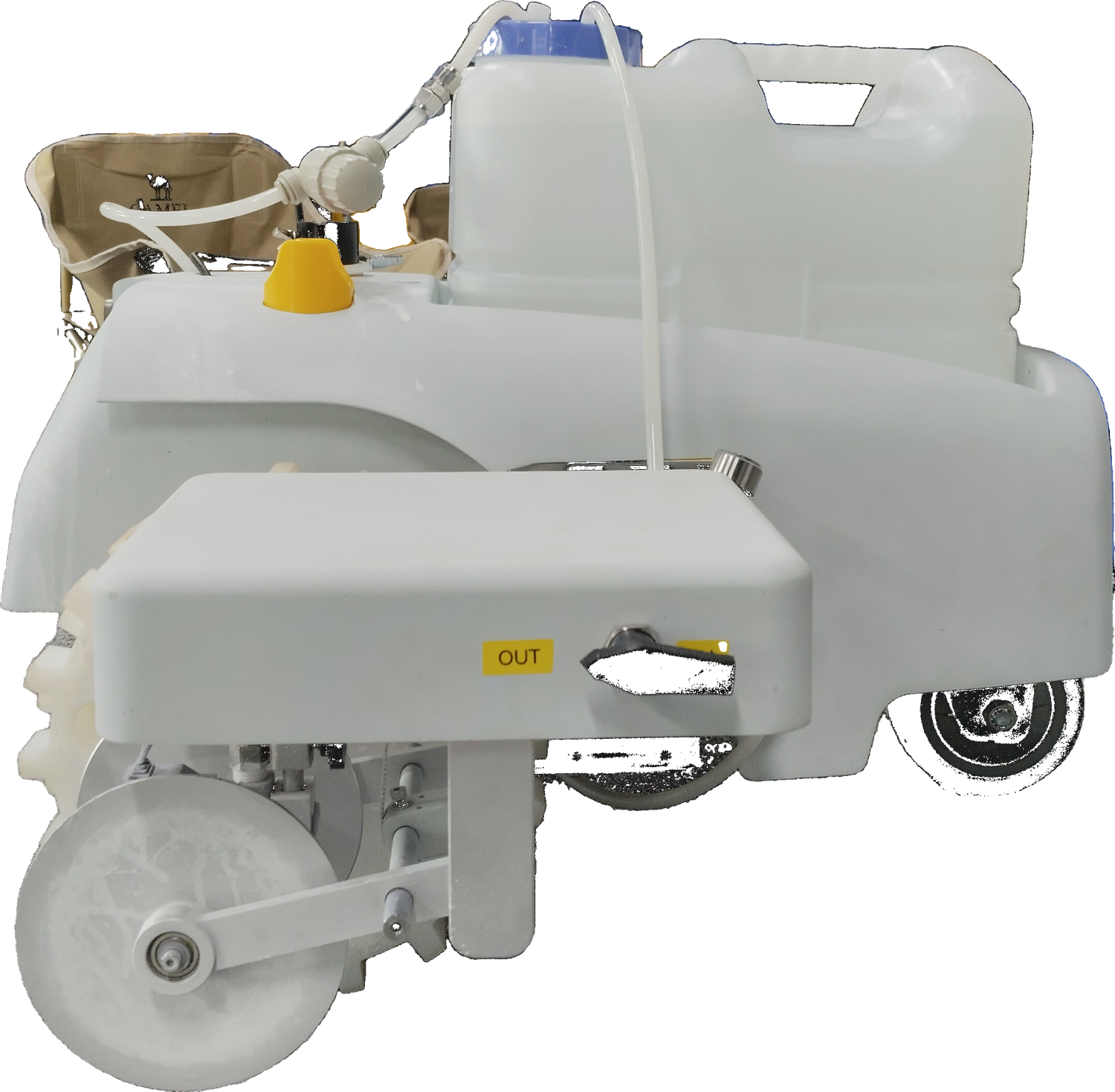
Intelligent marking robot
TR10Pro Line Marking Robot
RTK-guided line marking robot for sports fields, highways, municipal roads, airport runways and pre-marking workflows.
Centimeter-level marking accuracy3 times faster than manual workBuilt-in sports field templates
View model details →Unmanned surface vehicle
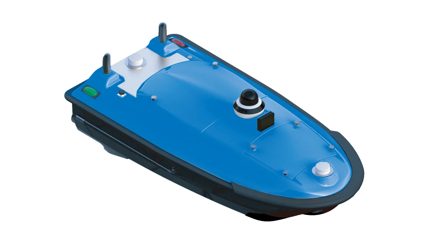
Tboat USV Series
Tboat10 and Tboat20 unmanned surface vehicles for bathymetric survey, water quality monitoring, patrol and hydrographic operations.
Tboat10 and Tboat20 platformsRTK positioning accuracy4G / 2.4G / optional radio communication
View model details →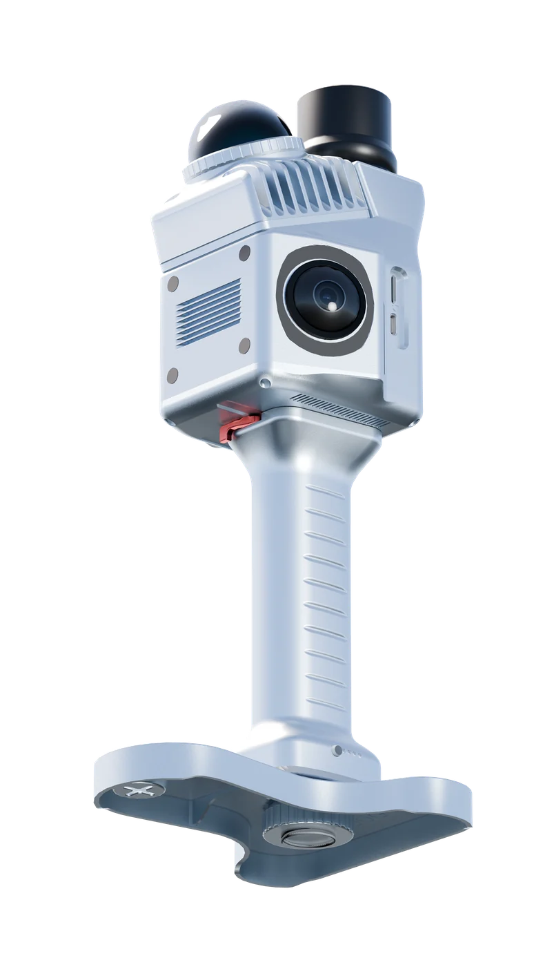
Handheld LiDAR SLAM scanner
TSR20 Handheld LiDAR SLAM Scanner
Lightweight real-time mapping LiDAR system for indoor and outdoor 3D point cloud capture in GNSS and GNSS-denied environments.
Livox Mid-360 LiDARSLAM / RTK-SLAM / PPK-SLAM modes1.0kg handheld design
View model details →Not sure which model fits your project?Send your country, application, quantity and preferred correction method. TOKNAV can recommend a suitable product package.
Get Recommendation →